GIS & spatial analysis
Decision-ready maps, spatial models, data integration, and custom workflows built around your actual project constraints.
ArcGIS · QGIS · Python · LiDAR
 SeaMountGeospatial Labs
GIS · Remote sensing · Environmental intelligence
SeaMount turns complex spatial data into practical decisions—from reefs and coastlines to cities, infrastructure, and the airspace above them.
What we do
SeaMount Geospatial Labs combines GIS, remote sensing, machine learning, and environmental science to reveal patterns that ordinary maps miss. We help researchers, engineers, planners, and communities move from data to confident action.
Core expertise
Flexible support for a single analysis, an ongoing monitoring program, or a custom geospatial platform.
Decision-ready maps, spatial models, data integration, and custom workflows built around your actual project constraints.
ArcGIS · QGIS · Python · LiDAR
Satellite and aerial imagery transformed into useful signals for land use, change detection, risk, and environmental health.
Clear spatial evidence for monitoring, compliance, remediation, resilience, and sustainable development.
Computer vision and machine learning that help specialists review imagery faster while keeping expert judgment in the loop.
Explore AI & data services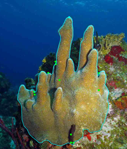
AI & data services
Purpose-built models start with carefully built data.
We develop computer-vision and geospatial machine-learning models around real operational questions. Our annotation workflows turn specialist knowledge into consistent, quality-controlled training data for detection, classification, and segmentation.
Open access ocean AI
A virtual coral expert for faster, more accessible image review.
Upload underwater images or video to detect and label Caribbean hard corals. Coral Intel returns bounding boxes and confidence scores in seconds—without requiring coding or machine-learning experience.
Best suited to Caribbean corals. Expert validation remains recommended for critical analyses.
Aerial systems
Bushwick Drone Co. is SeaMount’s aerial practice, combining FAA-certified flight operations with geospatial analysis and advanced data processing.
LiDAR scanning & high-resolution point clouds
Construction surveys & infrastructure inspection
Coastal, forestry & land-use monitoring
Orthomosaics, elevation models & 3D meshes
Build capability
Hands-on workshops in GIS, remote sensing, spatial analysis, and drone-data processing for professionals, organizations, researchers, and students.
Start a conversation
Tell us what you are studying, building, protecting, or trying to understand. We’ll identify the clearest next step.
Based in Brooklyn, New York